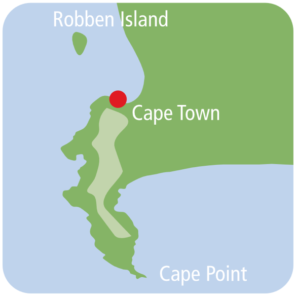
Historical Victoria & Alfred Waterfront & Cape Town’s link to the sea

In 1601, Van Spilbergen, a Dutch navigator, discovered one of the best natural harbours in the world, just 140 km up the west coast from Cape Town. He named it Saldanha Bay, after the Portuguese navigator,Antonio de Saldanha. Saldanha’s claim to fame was discovering Table Bay in 1503, a good halfway stop for replenishing ships on the long voyage to the East.The bay was called ‘watering place of De Saldanha’.The odd coincidence is that Van Spilbergen arrived at this bay in 1601, thinking he had found a new bay, and aptly named it ‘Tafel Baay’ – Table Bay.
The question needs to be asked: why did Saldanha Bay, an excellent natural harbour, lose out to Table Bay which has no natural harbour or protection from the extreme storms that lash the southern tip of Africa? The simple answer is: fresh water. Saldanha Bay had no fresh water and Table Bay had plenty.
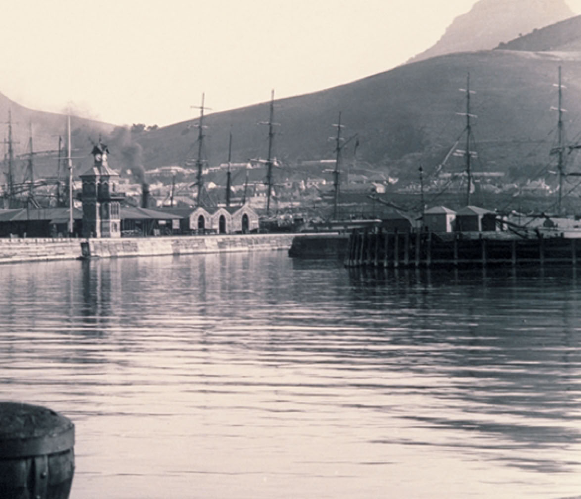
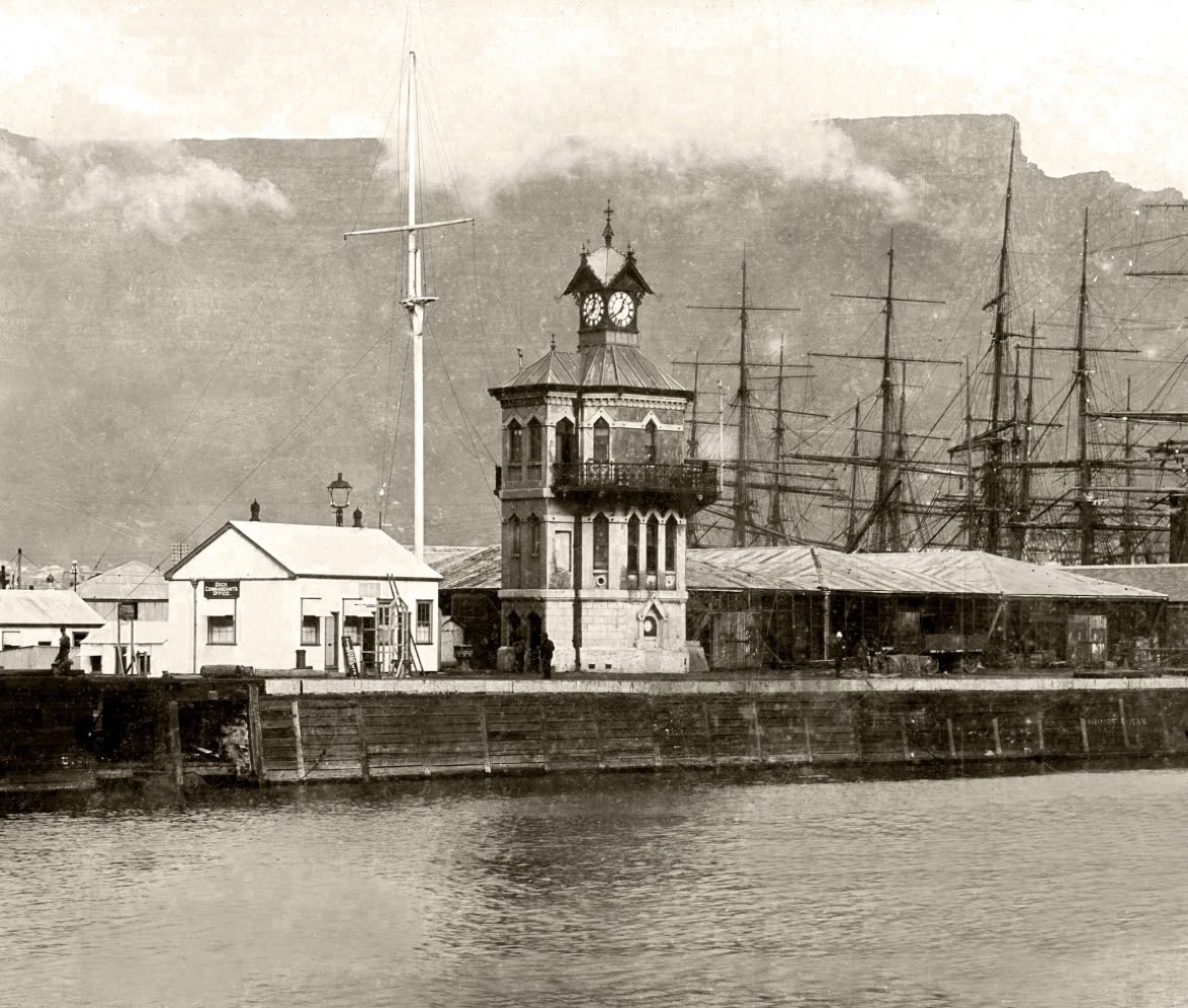
An early photo which must have been taken between 1882 and 1904, of the ‘cut’. The Clock Tower was built in 1882 and the Port Captain’s building, built in 1904, is not in the photo.
Courtesy of V&A Waterfront.
Van Riebeeck built the first permanent structure, the Fort de Goede Hoop. This was not as permanent as he would have liked, as it was made of mud and timber. At a later stage, the Castle of Good Hope (which can still be visited today) was built of stone.In 1656,Van Riebeeck also erected a jetty made out of a wooden deck supported on top of sunken wooden boxes filled with rocks. This jetty, the first structure to link the land and sea, was still in use in 1679 during the time of Simon van der Stel. Not all ships that stopped over at the Cape tied up at the jetty to load or offload cargo.They would anchor offshore at a safe distance; small boats, called cargo boats, were sent out to do this work. Highly skilled ‘Coloured’ local boatmen were recruited for this task as they knew the bay and its moods well.These men could make a fortune when the weather turned really bad: owners of ships in the bay would pay a great deal for an extra anchor to be rowed out to them. Good money was made but some boatmen who took this risk paid with their lives.
Cape Town grew at a rapid rate. The town spread along the beach and up the mountain. Along the beach, which was known as Roggebaai (‘Bay of Skate’), the fishing industry, sailors and townsfolk shared the same space.This was the important link to the sea that Cape Town lost when, in 1935, the 140 hectare Foreshore was created through backfill when the Duncan Dock was developed.
The Portuguese were the first to utilise the Cape as a halfway stop to the East but, unfortunately, some misunderstandings, cultural differences and exploitation of the indigenous people while trading, left 75 Europeans dead on the beach. As a result, the Portuguese decided to make Mozambique their halfway stop instead.
The other European powers started to useTable Bay as their halfway stopover. None had tried, at this stage, to set up any form of physical structure, be it a house, jetty or fort, to help them in their trading with the indigenous people. This was left to a Dutch merchant named Jan van Riebeeck who, in 1652, landed at the Cape to set up a permanent replenishment station under the orders of the Dutch East India Company (VOC). Water, vegetables from the newly planted company garden and fresh meat acquired from company livestock and trade with the indigenous people, were supplied to passing ships that put into the ‘Tavern of the Seas’.
Bad weather at the Cape had been a problem for shipping from the beginning; it was with good reason that Bartolomeu Dias, in 1488, called it ‘the Cape of Storms’. With many vessels shipwrecked or sunk as a result of the notorious storms,it is not surprising that there are many stories of tragedy and brave rescues, such as that by Wolraad Woltemade who drowned (with his horse) in 1773 after saving 14 people from the Jonge Thomas. After a particularly bad storm in 1737, Governor Swellengrebel took the first step towards protecting ships against the harsh winter weather and the dreaded northwester, which ripped ships from their anchors and drove them onto the rocks and beaches of Table Bay. He proposed a breakwater at Mouille Point. The VOC was approached for finance, to no avail. Swellengrebel then came up with another plan: every farmer dropping his goods off in Cape Town had to take a load of stones to the point, to be dropped into the sea to create a breakwater. Some 100 m had been built before the project was aborted as a result of lack of enthusiasm. The Dutch called this a moilje.
The French, allies of the Dutch, erected a battery at this site in 1781 and called it Mouille Point Battery (the French mouiller means ‘to drop anchor’).

Under Dutch rule, no more attempts were made to defend the Cape against the winter weather. They did, however, add two military batteries on the rocky site of the present-day Waterfront as a defence, not against any local threats, but against less than friendly European powers. The first to be built was the formidable fortification of the Chavonnes Battery, started in 1714. This battery has been restored and can be visited in the Nedbank Clocktower building. In 1784, the second battery to be constructed was the even larger Amsterdam Battery. This battery was located near the City Lodge, but remained buried under years of rubble and city growth, until Battery Park was developed in 2018 and portions of the battery were unearthed.These forts were among more than 28 that were built around Table Bay during both Dutch and British rule; this gave rise to Cape Town being referred to as ‘the Gibraltar of the South’.
Under British Rule
The British took control of the Cape in 1795 for eight years, a period known as the First British Occupation. They returned in 1806, defeating the Batavian Republic at the Battle of Blaauwberg to usher in the Second British Occupation. During British rule, ships were still being sunk and wrecked in Table Bay at an alarming rate. The first British effort to prevent this was the building of a stone pier at the bottom of Bree Street; this pier was completed but proved to be almost useless.
A second stone pier was built at the foot of Adderley Street, and a large wooden pier was constructed at the site of Van Riebeeck’s jetty. Ships could now offload and take on cargo straight off the land without relying on cargo boats to come out to where they were anchored. However, these piers proved to be inadequate as a defence against the winter storms.

In honour of South Africa’s Nobel Peace Laureates, four larger-than-life-size bronze statues of Desmond Tutu, Chief Albert Luthuli, former presidents FW de Klerk and Nelson Mandela, were erected in Nobel Square near the Peace and Democracy sculpture.
There was a safe, natural harbour in False Bay that was perfect for winter anchorage. It had been discovered by Simon van der Stel in 1687 and became known as Simon’s Town. This harbour was developed by the British but, unfortunately, it was not a suitable replacement for Table Bay as a port, firstly because there was only a narrow area between the sea and the mountain for the town to grow; secondly, Cape Town was too well established to be replaced, and thirdly, its distance from Table Bay meant a two-day journey by ox wagon over difficult terrain.
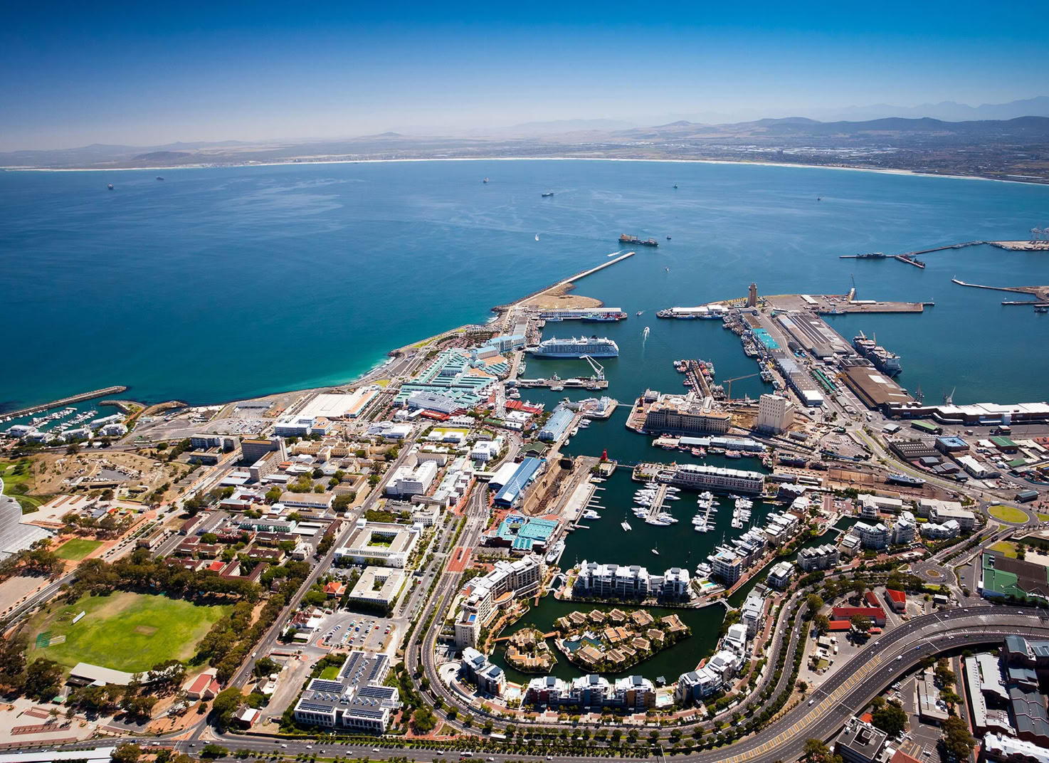
The Victoria and Alfred Basins
Thus, with no satisfactory alternative as a safe natural harbour, the authorities knew a manmade harbour had to be built. Cost was a major problem and politics played a part: other ports had been established up the east coast of southern Africa and were vying to be the main stopover port on the route to the East.

In 1856, Captain James Vetch came up with the first plans for an enclosed harbour with an inner and outer basin. This harbour would be protected by two breakwater piers. The following year, a major storm hit Cape Town, sinking 16 large ships and 7 smaller boats. Three days later, the storm hit again, taking two more large ships to the bottom of the bay. Despite this, the harbour was still not started – the cost was prohibitive. The final decision to build the harbour was taken because of the news that the insurance company, Lloyds of London, would refuse to cover any ship that anchored at the Cape during winter because of financial losses as a result of numerous shipwrecks.
Because of this, Thomas Andrews, a shipbuilder (designer of the Titanic), submitted a modification of an earlier design by John Goode. This was approved by the governor of the Cape, Sir George Grey. These plans positioned the harbour way off
In 1856, Captain James Vetch came up with the first plans for an enclosed harbour with an inner and outer basin. This harbour would be protected by two breakwater piers. The following year, a major storm hit Cape Town, sinking 16 large ships and 7 smaller boats. Three days later, the storm hit again, taking two more large ships to the bottom of the bay. Despite this, the harbour was still not started – the cost was prohibitive. The final decision to build the harbour was taken because of the news that the insurance company, Lloyds of London, would refuse to cover any ship that anchored at the Cape during winter because of financial losses as a result of numerous shipwrecks.
Because of this, Thomas Andrews, a shipbuilder (designer of the Titanic), submitted a modification of an earlier design by John Goode. This was approved by the governor of the Cape, Sir George Grey. These plans positioned the harbour way off to the right of Roggebaai, the normal place for shipping activities in those days. The reason for this was the need for a solid rock base from which a harbour could be cut, with the cut rock being used to create a breakwater. The rock type was a hard shale called Malmesbury shale.


The Robinson Graving (Dry) Dock was officially opened in 1882 by Governor Sir Hercules Robinson after whom it was named. During the war, between 1941 and 1944, over 300 ships were repaired here and, today, it is one of the few of its age still in operation in the world.
It is said that the Breakwater Prison was one of the most feared prisons in the world, along with Dartmoor and Devil’s Island, and that there was at least one representative of each race or nationality of the known world in this prison. Racial segregation was not an issue at first; in fact, the sleeping arrangements were that a white convict had to sleep between two black convicts. The rationale for this was that, with language and cultural barriers, there would be less plotting and dissent. One of the largest groups within the prison consisted of those convicted of illicit diamond buying on the Kimberley diggings. These men (known as IDBs) were not hardened criminals as such, but an uncut diamond found in a pocket meant five to ten years at the Breakwater. Progress on the 1430 m breakwater depended largely on the rate of conviction of IDBs.
to the right of Roggebaai, the normal place for shipping activities in those days. The reason for this was the need for a solid rock base from which a harbour could be cut, with the cut rock being used to create a breakwater. The rock type was a hard shale called Malmesbury shale.
On 17 September 1860, the 16-year-old second son of Queen Victoria, Prince Alfred, pulled a silver trigger that ceremonially released a truckload of rocks into the sea. Twenty thousand people turned out near the present site of the Chavonnes Battery to watch this historic event; among this crowd were the Xhosa chief, Sandile, and Soga, the first black Presbyterian minister in South Africa. Prince Alfred returned a few years later to officiate at the opening of the Alfred Basin. This was followed by another visit to lay the foundation stone for the Robinson Dry Dock.
The tale of the V&A harbour would not be complete without the story of the people who built it with blood, sweat and tears. The authorities realised that it would be too expensive to hire paid workers so they turned to convict labour. The first convicts were housed in the Chavonnes Battery. When half the battery was pulled down to make way for the basin, they were moved to the newly built Breakwater Prison (present-day site of the Breakwater Lodge Hotel). By the year 1885, there were over 2360 convicts working on the basin and breakwaters.


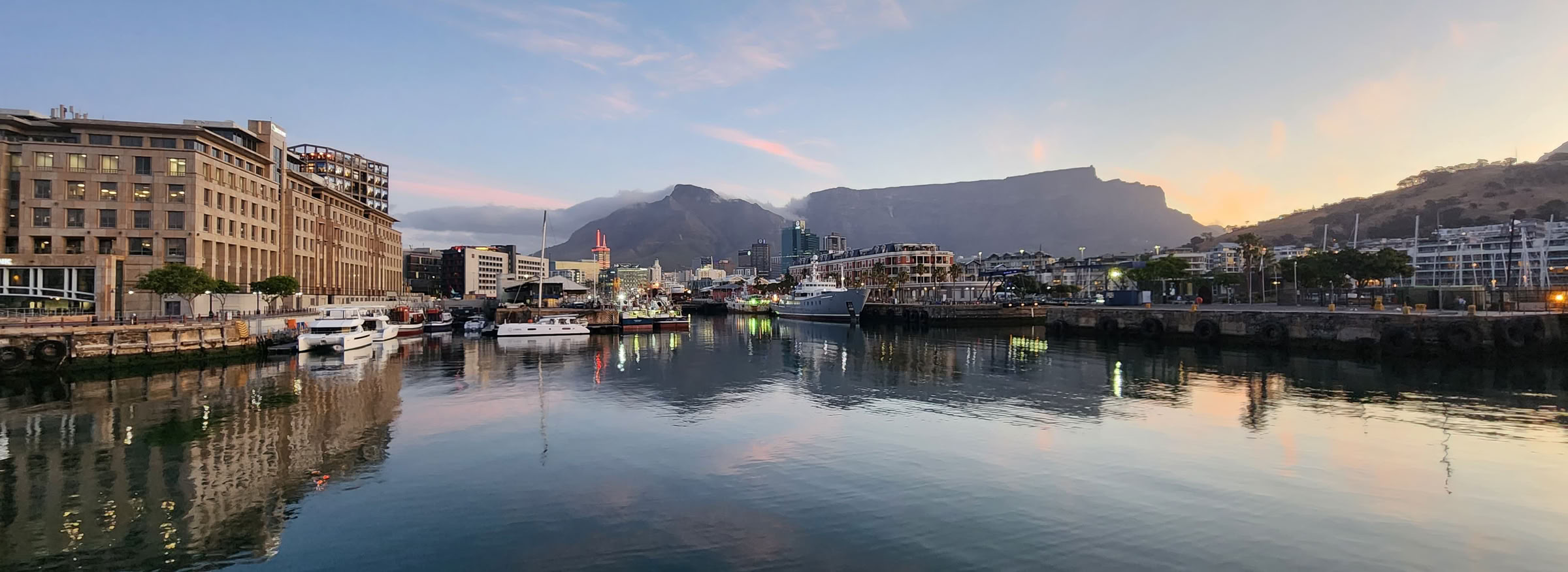
Victoria Basin with the Clock Tower (far left), the blue Port Captain’s Building, Harbour Café building (centre) and, behind it, the Victoria & Alfred Hotel, with Devil’s Peak and Table Mountain providing the backdrop.

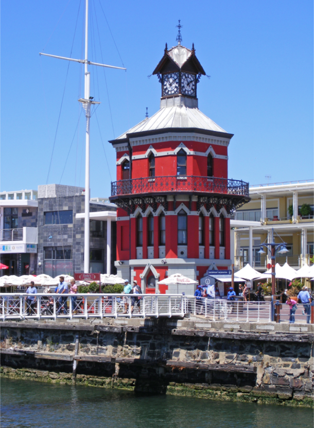
The Clock Tower built in 1883 used as the Port Captains office was originally painted white. During the AngloBoer War and WW1 it was taken over by the Royal Navy.

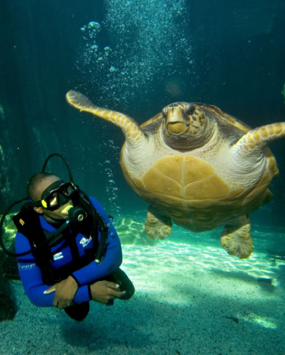
The Two Oceans Aquarium is a world-renowned facility that showcases the unique marine life found at the meeting point of the Indian and Atlantic Oceans. Established in 1995, the aquarium is home to more than 3,000 marine animals, including sharks, penguins, rays, and a variety of colorful fish.
The V&A Waterfront
There were a number of factors that brought the V&A Waterfront into existence as we know it today. Up until 1935, Cape Town had a strong connection with the sea and its beaches which, therefore, played an important role in the lives of the city’s inhabitants. Small-boat fishermen made a living from the sea, and it was a focus of leisure activities on Roggebaai and Woodstock beaches. In 1913, at the bottom of Adderley Street, the City of Cape Town built a wooden pier which reinforced the notion of leisure and pleasure: it was a wonderful amenity open to all; it served as a promenade and included a large bandstand – at one stage, it even housed a full circus, including elephants. As entertainment became the primary focus in this area, the fishermen were pressurised out because the process of drying fish in the sun was a smelly business.They also could not set up shop in the harbour because of the cost and competition from large fishing companies.
From 1870, poorly paid contract workers were introduced, first from Mozambique, then from Ireland and finally the Mfengus were brought in from the Eastern Cape. By 1891, racial segregation had been introduced. Black convicts stayed at the Breakwater Prison and whites were moved to the new Industrial Breakwater Prison next door (now the Graduate School of Business). In 1901, when the bubonic plague struck Cape Town, some people laid the blame for this on the living conditions of the black workers and their families at the harbour. After losing a long fight, they were moved to a newly designated site called Ndabeni outside town.
By 1905, the South Pier and Victoria Basin were complete which meant larger ships could visit but a number of factors led to the new harbour becoming inadequate within four years. The first was the increased traffic of ships visiting the Cape due to the Gold Rush on the Witwatersrand, the Diamond Rush at Kimberley and the Anglo-Boer War. The advent of steam ships, which were far bigger than sailing ships, meant that some larger ships could not use the Alfred Basin.
The authorities tried to remedy this by building a new basin on the east side of the South Pier (1925-1932). This new basin (Southern Basin) disappeared, virtually before it was started, when, in 1935, the Duncan Dock was built fromWoodstock Beach; the dredged rock and sand were used as backfill to reclaim land all the way back to the present-day Strand (Beach) Street and the new basin and old waterfront (Roggebaai) became the Foreshore of today. In 1975, an even bigger basin, the Ben Schoeman Dock, was built beyond the Duncan Dock. Up until 1930, the V&A Harbour was the undisputed gateway to southern Africa, but its decline came as a result of containerisation, air travel, the opening of the Suez Canal and the diminishing number of cargo and passenger liners that travelled the seas.
This link between the town and the sea was undermined in the mid-1930s.The building of the large Duncan and Ben Schoeman docks saw the demolition of the pier, the loss of Roggebaai and Woodstock beaches (the latter also smothered by the industrial area of Paarden Eiland) and the reclamation of the Foreshore. The subsequent development of the elevated freeway system on the Foreshore further isolated the people of Cape Town from the sea.
With these changes began a period of degradation for the area around the Victoria and Albert basins.They continued to be used by the fishing industry and for small-scale ship repairs but, by the ’60s and ’70s, the V&A harbour was isolated (as access was controlled by Customs), derelict and under-utilised,and developers had their eyes on it. In 1984, the mayor of Cape Town, Sol Kreiner, formed a Waterfront Steering Committee with the aim of linking Cape Town to
the sea once again. Under the chairmanship of Arie Burggraaf (SA Harbours’ Chief Engineer at the time), a committee was appointed to investigate increased public use of harbour areas.

Work on the 123 hectare site was planned in six phases, partly for financial reasons. Because of apartheid, South Africa was isolated from overseas investors and in an economic recession. Local financial institutions were not interested owing to the risks involved in a new, untested development of this scale on the African continent. In addition, with no big financiers in the form of the government or the private sector coming to the party, the V&A had to be a successful commercial business from the outset; if the new development was introduced in phases, each completed phase could pay for itself straight away, which meant the overall financial burden would be reduced.
The start-up capital (R205 million) came from Transnet and a mix of tenants, operators and residential sales. Visitors would later bring revenue into the business. Development of the first phase, the Pierhead Precint, which had existing buildings that needed refurbishing,was started at the end of 1989. The next phase was the construction of the Victoria Wharf. This was an important development as it would be the main engine for revenue for the Waterfront.
In 1987, the committee submitted a report to the Minister of Transport Affairs and of Environmental Affairs and Tourism, stating that the area known as the historic docklands should be given a new life with a mix of tourism, retail and residential developments alongside a working harbour (This concept was not new as it had been applied around the world with varying degrees of success, but most Capetonians cynically viewed it as unrealistic – an illusion rather than a vision.)
The South African government accepted the committee’s recommendation in 1988. As a result, at the end of the year, the Victoria and Alfred Waterfront (Pty) Ltd was established as a wholly-owned subsidiary of what is now Transnet Ltd which owned most of the V&A at the time.This new company would act as the developer of the project, which was to be steered by David Jack, the Chief City Planner of Cape Town.
This attention to detail, with a focus on preserving heritage and enhancing the overall experience of a working harbour (and avoiding a‘DisneyLand’atmosphere), has made theV&A the most successful real estate project in SouthAfrica. In the words of Pieter van Zyl,‘ … as a sustained piece of quality city-making it is without parallel in South Africa ... Although it has become South Africa’s top tourism destination, the V&A Waterfront has achieved much more than that – it has re-united Cape Town with its proud maritime heritage.’
In 1996, Transnet sold the V&A Waterfront to the Transnet Pension Fund. In 2006, it was sold to a Dubai consortium for R7 bn. (This sale had Cape Town in a panic as it was falsely reported in some newspapers that half of Table Bay had been accidentally sold in the deal.) It was subsequently bought back for R9.7 bn by a South African consortium consisting of Growthpoint and the Public Investment Corporation (PIC), representing the Government Employees’ Pension Fund and a small BEE consortium.
The story of the Waterfront is still unfolding with new projects underway. One of the most important decisions taken by the V&A is that to ‘Go Green’. With sustainability as its base, this has been accomplished with irrigation, recycling and energy-saving initiatives as well as the installation of renewable-energy systems.


The Breakwater was started in 1860 but the full 1500 metres was only completed in 1927. Only a small part of it can still be walked today as most of it had to be demolished to make way for the new V&A Waterfront. Walk through the Table Bay Hotel or along Quay 6 to the breakwater walkway by climbing some steps.


From 1901, the Industrial Breakwater Prison housed white convicts who worked on the construction of the Breakwater.

The Treadmill at the breakwater prison was a cruel invention which was used to punish the prisoners. This revolving staircase rotated when stepped on and the offender had to keep climbing the steps to avoid having his shins lacerated or smashed by the revolving planks.
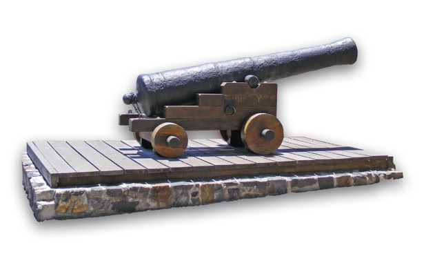

One of the 20-pounder cannons of the Chavonnes Battery
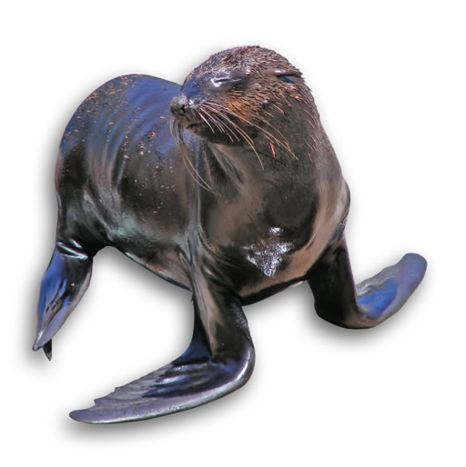
Cape Fur Seals can be seen all around the harbour. The two best places to see them are the Seal Landing next to the Clock Tower and a landing outside the Two Oceans Aquarium. To swim with the seals go to www.sealsnorkeling.com
Sites of the Waterfront
The numbers correspond with those in red on the map on this page.
1. Robinson Dry Dock
When the harbour was designed, the Royal Navy made a request that a dry dock be included, which could serve their interests in the southern hemisphere. Measuring 161.2 m by 20.7 m and with a depth of 7.9 m, this dock remained the largest dry dock in the southern hemisphere for many years. It was officially opened in 1882 by Governor Sir Hercules Robinson, after whom it was named.
During WWII, over 300 ships were repaired here; today, the Robinson Dry Dock is one of the few of its age still in operation in the world. The Pump House next to it housed the machinery to pump out the water. (This building was the location of the Planet Hollywood restaurant in the late ‘90s and was the scene of the infamous 1998 bombing which injured 25 people and resulted in one death. This was one of a number of bombings that rocked Cape Town during a turbulent time involving gangs and extremists.) In the early 1900s, apart from normal business activities, swimming galas and rowing regattas took place in the dock.
2. Chavonnes Battery
(Closed to the public at the moment) The Chavonnes Battery can be found near the Clock Tower. Part of it is outdoors, where you can view the original defensive wall, cannon positions, original shoreline and arsenal rooms below. The remaining section is underground in the Nedbank building.To enter this section, when opened again, a small admission fee is required but it is really worth a visit. This battery was the first major defence facility built (1714 to 1725) by the Dutch East India Company after the Castle. Its purpose was to defend the anchorage in the bay; this was achieved by an overstocking of cannons and mortars. Some of the cannons had a range of 1500 m. When the British retook Cape Town in 1806, they chose Blaauwberg as a beachhead as they knew a direct assault on Cape Town via the bay would be extremely dangerous because of the fire power of this battery. The battery was also used as a prison, an isolation wing for the hospital and, in 1836, as a smallpox isolation hospital.
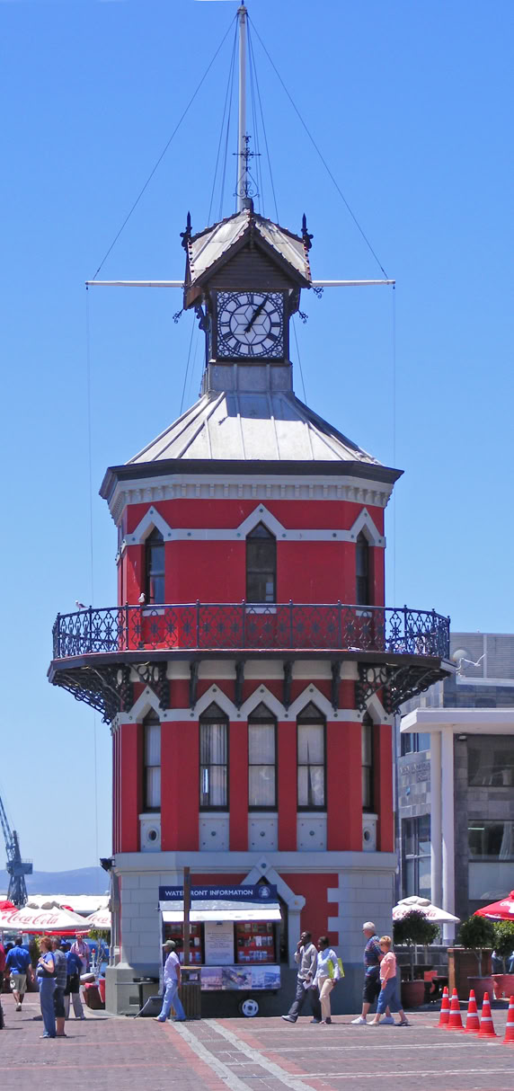
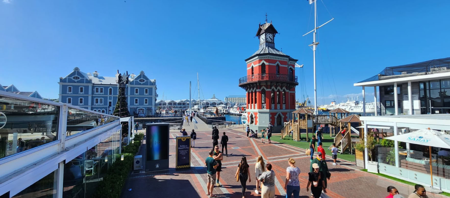
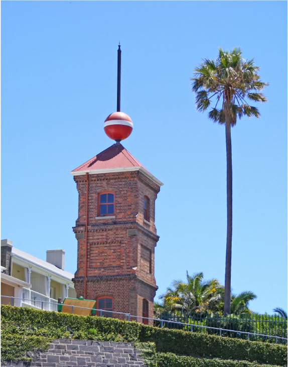
3. Clock Tower
This octagonal Victorian, Gothic-style Clock Tower was built in 1883 and was the Port Captain’s first office in the newly constructed harbour. It housed the tide gauge mechanism which worked by a shaft connected to the sea.
This was necessary to read the levels of the ocean and relay tide information to passing ships. It also contained all the instruments that the Port Captain needed such as a clock for ships to see the correct time, signal flags, Morse lamps and a telescope.
Within the three-storey, single-room-per-floor building, there was a snug reading room for ships’ masters; the second room was the mess and the last was a room made up of mirrors on all the walls so ships could be seen from every angle. The Clock Tower was also known as the Dock Clock or Tide Gauge Tower; its original colour was white.
During the Anglo-Boer War, the Tower became the headquarters of Admiral Chichester and his staff and the Royal Navy occupied it again during WWI. One of the greatest sights from this tower must have been the 128 ships seen in the harbour and bay one day in 1901; not even the two World Wars mustered this number of ships here on a single day.
4. Old Port Captain’s Office
With the rapid growth of the harbour, the Port Captain, who was housed in the Clock Tower, moved across the ‘cut’ into this beautiful gabled building which was built in 1904.This new location offered him the space to perform a demanding, important job. So essential was his job that the first telephone line in the Cape Province (1904) ran from his office to the post office in Darling Street.
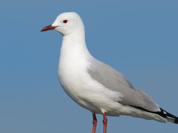
Hartlaub’s Gull
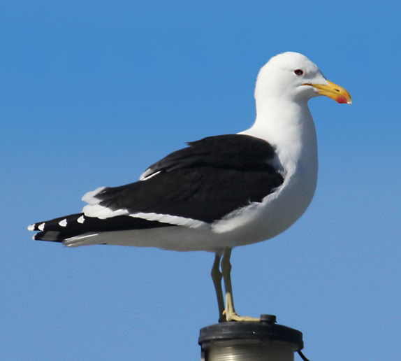
Kelp Gull
The iconic Clock Tower built in 1883 used as the Port Captains office was originally painted white. During the AngloBoer War and WW1 it was taken over by the Royal Navy.
14. Nelson Mandela Gateway
This is the embarkation building for visitors to Robben Island. Bookings for guided tours are essential and can be made by calling 021 419 1300. The Robben Island Exhibition and Information Centre is situated next door to the Clock Tower building, and is a unique museum depicting the history of Robben Island and the struggle for democracy.
5. Time Ball Tower
The Time Ball on this tower, situated on top of Portswood Ridge, was invented by Captain Robert Wauchope and built in 1894. Its function was to relay the time to ships in the harbour. This was done by simply dropping the ball along the shaft at a given time indicated by the Cape Royal Observatory, so that the ships’ masters could determine accurate time for effective navigation. It remained in use for 40 years, until new technology took over. It then lay idle for 63 years before being restored and officially recommissioned in November 1997.
6. Dock House
This was the residence and offices of the Harbour Master when the port consisted only of theAlfred Basin.This white double-storey building was built in 1870 on the Portswood Ridge which offers a commanding view of the harbour.The Dock House is now the Dock House Boutique Hotel & Spa.
7. Quarry Tunnel
On the opposite side of the road from Ferrymans Pub, you will see two old wooden garage-style doors. These were once the original doors of the Mitchell’s Scottish Ale House. Behind these doors is a tunnel that runs beneath the ridge above.The purpose of this tunnel was to convey stone from the quarry above down to the breakwater.
8. Rocket Lifesaving Equipment
During the Victorian age, an ingenious sea-rescue device was housed in a narrow building next to Mitchell’s Brewery. This consisted of a harpoon rocket device that would shoot a trailing rope over a stricken ship; after the rope was made secure, a bosun’s chair ran along the rope, thus ferrying crew to safety. Part of this system consisted of a plank with instructions to be read by the stricken ship’s crew. One of these planks can still be seen today at the counter of the NSRI building, which now has an Information Centre. (This equipment can also be seen at the Chavonnes Battery.)
9 & 10. Breakwater Prisons and Treadmill
The engine that drove the building of the V&A harbour was the thousands of convicts who were housed for ten years in these three prisons.Taking a short walk up Portswood Road, you will find an entrance in a very high wall. There is no indication that something interesting lies beyond this entrance but what you will see here is worth a visit. As you enter, immediately to the left you will find the dreaded treadmill. This highly sadistic device was invented as a punishment for laziness and insubordination. One or more convicts would stand on the steps; the brake would be released,
causing the steps to rotate at the rate set by the prison guard. If the poor convict did not step fast enough, he would have his shins smashed by the spinning steps above. These punishment sessions could last the whole day. Next to the treadmill are the isolation cells for repeat escapees and other hard nuts to crack. Behind the cells, facing the sea, is a long, high wall of slate. From a distance, it seems to be just a wall but, on closer inspection, you will note that it is full of hundreds of very old drawings and inscriptions scratched or etched by the inmates. Look out for the cartoon of President Kruger among the 150-year-old graffiti.Behind this wall is the first Breakwater Prison (1860) that housed both white and black inmates.
13. Nobel Square
Nobel Square is situated between the Pump House and the Victoria & Alfred Hotel. This small area has four larger-than-life bronze statues. They were sculpted by acclaimed artist, Claudette Schreuders. The statues immortalise the great South African Nobel Peace Laureates, namely Chief Albert Luthuli (1960), Archbishop Emeritus Desmond Tutu (1984), and former presidents FW de Klerk (1993) and Nelson Mandela (1993). Former Western Cape Premier, Ebrahim Rasool, summed up the great significance of the square: “Each Laureate played his own meaningful and different role in achieving peace and democracy, each one at a different time of the struggle, while sometimes uniting their efforts. They came from different political backgrounds, from different races and origins and spoke different languages, but together the four left an indelible mark on the South African landscape.” Near these statues is the Peace and Democracy sculpture (sculpted by Noria Mambasa) acknowledging the contribution of women and children to the attainment of peace.
15. Seal Landing
This is one of the many places in the harbour that the Cape Fur seal (SouthAfrican Fur seal) has decided is a good sunning spot. These seals are normally found in large colonies (500 -1500) around the Cape extending up to northern Namibia. They are highly opportunistic and therefore the harbour is a good place to get scraps thrown off the many fishing vessels. It also offers some protection from Great White sharks, their natural enemy. The adult male is just over two m long with a mass of 200 -300 kg. Females are much smaller at 1,5 m and weigh between 50 and 75 kg. They tend to be quite friendly to scuba divers in the water, but on land, they can get panicky around people and could become dangerous.
16. Ferrymans Tavern/ Mitchell’s Scottish Ale House
Ferrymans and Mitchell’s Brewery were the first two businesses to be launched under the banner of the V&A Waterfront. The original building, built in the 1860s, was part of a warehouse. Near the Clock Tower was Bertie’s Landing, named after well-known sailor, Bertie Reed. This was also a favourite watering hole during those early years. Prior to the construction of the Swing Bridge, pub crawlers had to cross the ‘cut’ in a small rowing boat called the Penny Ferry to get to Ferrymans and Mitchell’s Brewery on the other side. Bertie’s was demolished to make way for the Robben Island Museum and Nelson Mandela Gateway ticket office.
17. Harbour Café Building
This was the first restaurant in the harbour to open its doors in 1903. It was built on Erf 1, the same location as Cape Town’s first post office. It opened as a tea room, later known as The Crow’s Nest. Thereafter, the Hildebrand Restaurant (classed a Ristorante Italiano, an accolade awarded by the President of Italy) operated from this historic site. Today, it is owned by Tourvest.
18. Boat House
In the early 1900s, this red corrugated-iron building was where the firm Louw and Halvorsen built many wooden boats, tugboats and other small craft. Some can still be seen around the harbour today. This building is now occupied by Cape Union Mart.
19. Moving Bridges
Of the three moving bridges in the Waterfront, the oldest is at the entrance to the Robinson Graving Dock (1882) which opens and closes sideways to allow ships in for repairs and maintenance. The second was built in 1996 to provide direct access for pedestrians from the CBD and the Cape Grace Hotel. This vertically opening bridge is known as the Bascule Bridge. In 1997, the Swing Bridge over the ‘cut’ was constructed. Before this bridge was built, anyone wanting to cross this gap had to pay the ferryman one penny to get to the other side.Abdul, the first ferryman, who spent almost his whole life in this job, estimated that he had rowed the equivalent of twice around the world
The authorities thought a mixed prison would stop dissent, because of differences in language and background. A strike in 1885 disproved this theory: the strike was blamed on the mixing of races, so the Industrial Breakwater Prison (present-day Graduate School of Business) was built. This is the building with four square turrets on the corners. This design was the standard British prison design of the day. From 1911 to 1926, it was used to house juvenile offenders; from 1926 until 1989, black dock workers lodged here.
The authorities thought a mixed prison would stop dissent, because of differences in language and background. A strike in 1885 disproved this theory: the strike was blamed on the mixing of races, so the Industrial Breakwater Prison (present-day Graduate School of Business) was built. This is the building with four square turrets on the corners. This design was the standard British prison design of the day. From 1911 to 1926, it was used to house juvenile offenders; from 1926 until 1989, black dock workers lodged here.
11. Union Castle House
This building was designed in 1919 by Baker, Kendall and Morris. For many years, it served as the dock offices for the Union Castle Mail Steamship Company. In 1857, this company secured a contract to carry mail between Cape Town and England every month. Fifteen years later, a competitor, the Castle Mail Packet Company, was formed. Its ship, the Windsor Castle, made the trip in a record-breaking 23 days.This event changed the existing mailing contract so that both companies got an equal share. Ships would now depart weekly and a one-way trip would not exceed 26 days. The two companies eventually merged in 1900 as the Union Castle Mail Steamship Company. But, by the mid-1960s, both cargo and passenger numbers were starting to decline and the last mail ship sailed from A Berth in 1977.
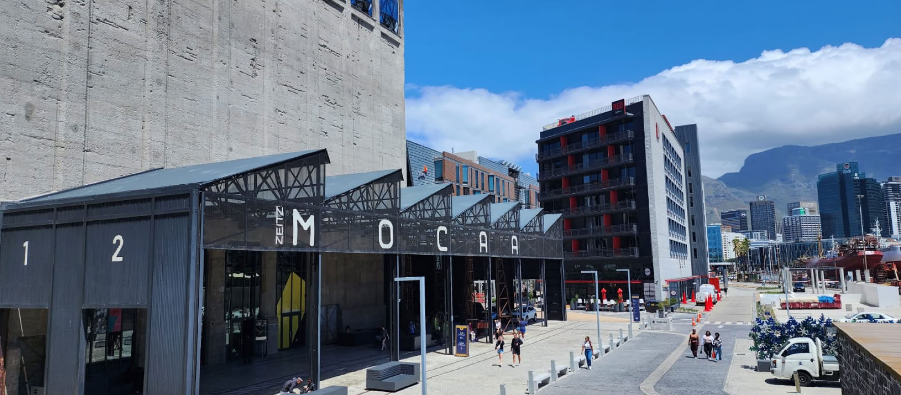
12. Zeitz MOCAA
In 1924, the Grain Silo, at 33 m high, was the tallest building in Cape Town but, with the advent of the V&A Waterfront, the historic silo was destined for destruction.This is where history and art meet. Thomas Heatherwick, through Ravi Naidoo, saved the building by repurposing it as an art venue. Jochen Zeitz built up a collection of contemporary art from Africa and its diaspora to house within its award-winning redesign of the building. The Zeitz MOCAA opened its doors to the public in 2017 as the premier and largest art exhibition in Africa which showcases contemporary African art.

20. Victoria & Alfred Hotel
Formerly the North Quay Warehouse, this building was constructed in 1904 and was originally used as a cold store. It was then converted into a warehouse and baggage store for the Union Castle Shipping Line (see number 11). In recent years, this building has been completely restored and became the first hotel to be opened at the Waterfront. The old rope store was at the sea end of the building and is now La Parada restaurant.
21. Somerset Hospital
Somerset Hospital, opened in 1864, was the first civilian hospital and is a national monument. The hospital, named after Lord Charles Somerset, the governor of the Cape Colony who gave land for the construction, replaced the Chiapinni Street hospital. The cornerstone of the new hospital was laid on 18 August 1859 by the Cape governor, Sir George Grey. Nurses were recruited from the Florence Nightingale School of Nursing and Midwifery, St Thomas’ Hospital, London. The hospital subsequently established its own training school for nurses and became the first hospital to train‘non-white’ nurses.The original hospital houses the Cape Medical Museum.
For More Information
General Information
For information about times, events and activities, contact the V&A Information Centre on 021 408 7600 or visit www.waterfront.co.za
Sources
• Cape Town on Foot: Ursula Stevens
• Cape Town:T V Bulpin
• Tavern of the Seas: Lawrence Green
• V&A Waterfront development:
capeinfo.com
• The Waterfront Story: Carl Momberg
• www.waterfront.co.za
All information is given in good faith but, as times and facilities may change, the author and publisher cannot be held responsible for any inaccuracies.
Proofreading: Shelley Brown & Shelley Woode-Smith
Distribution: Go.See.Do
Additional citations available on request.
© Richard Smith • 18th edition, 2024 • Gateway Guides


DISTRIBUTION PARTNER
www.gatewayguides.co.za
All Rights Reserved
Contact us if you wish to engage with any of our products

IN ASSOCIATION WITH